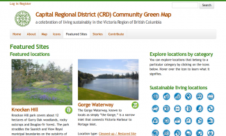
The Capital Regional District (CRD) Community Green Map is a further project for the Community Mapping Collaboratory at the University of Victoria. Bringing together academic and community partners, the Collaboratory produces both print and online maps, focusing on engaging communities in the process of mapping community assets.
The CRD Community Green Map is built around the Debut Location feature, extended to incorporate a wide array of imagery as well as the striking Green Map icons, some of which have been produced to reflect the ecological uniqueness of Southern Vancouver Island and the Gulf Islands.
Custom work on this site also extended the Location feature to create place-based stories that could then be related to locations, providing a rich interconnection between place and the meaning of place. First Nations stories are also prominently featured, reflecting the unceded territory on which the CRD and City of Victoria exist.
Our work on the project began with the turning the vision for the site into a detailed technical plan, working with team members to create user stories to guide site development, creating the site framework including content types, views and panels pages as well as training the student interns on posting content and site management.